Unlimited mileage,
results in 48 hours
results in 48 hours
Measure
PCI with
a simple smartphone
PCI with
a simple smartphone
PCI Inspection

Navigate online
or export
or export
4

Roadly will
process data and calculate PCI
process data and calculate PCI
3

How it works

Upload data
to the cloud
to the cloud
2

Record video with
a simple smartphone
a simple smartphone
1

Roadly will process data and calculate PCI

3
Navigate online
or export
or export
4


Record video with
a simple smartphone
a simple smartphone
1

Upload data
to the cloud
to the cloud
2

Receive a comprehensive evaluation of a sample road segment, complete with detailed analysis of its condition.
5 miles of the PCI Inspection are included in our free trial
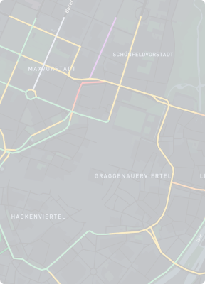
Demo map: See in action
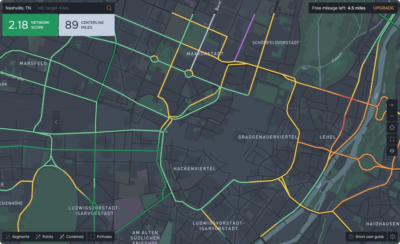

City of Nashville DOT:
pavement inspection
pavement inspection
Minnesota DOT:
traffic signs inventory
traffic signs inventory
Roadly case studies
NYS DOT: inventory
of reference markers
of reference markers
NYS DOT:
guardrails inventory
guardrails inventory

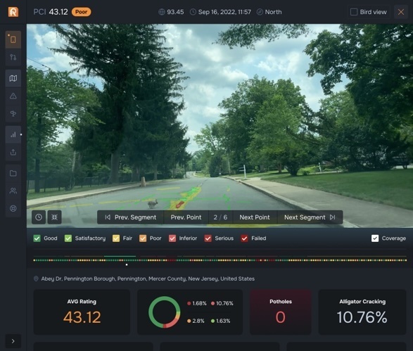
Our AI has been trained to recognize different types of damage and their level of severity according to the "Distress Identification Manual for the Long-Term Pavement Performance Program." Linear measurements are performed by our visual-based algorithm from input frames.
is determined based on various statistics related to the defects and damage present in a sample section of a road. This index is influenced by the quantity of defects observed, their level of severity, and the applicable measurement metrics (such as length, width, or area).
Pavement Condition Index
The PCI

Improve road safety and address
issues promptly
issues promptly
Enhance efficiency with accurate and up-to-date road condition information
Streamline inspection process
and reduce manual assessments
and reduce manual assessments
Easily gather and track pavement data with AI technology
Save time and money
with smartphone
road inspections
with smartphone
road inspections
Seamlessly integrate the collected data with your existing GIS and work order systems.
Make informed decisions about maintenance and repair strategies.
Streamline both long-term capital planning and daily road inspections.
Enhance annual budget planning and communicate budgetary needs to the city council using data from Roadly.
Identify roads in need of maintenance or repair and effectively prioritize tasks.
Receive an objective assessment of road conditions using the Pavement Condition Index in under one month.
Efficient way to monitor
your road networks
your road networks


Efficiently dispatch your maintenance crews directly using Roadly's web-based map to address the detected pavement distresses.
Strategically plan repair routes by visualizing the pavement distresses and their severity.
Our system utilizes machine learning to objectively rate road conditions, offering a solution that is more cost-effective and expedient than traditional inspection methods. Roadly delivers near real-time analytics, measuring, identifying, and tracking road issues, complete with GPS coordinates of each detected pavement distress.
Make data-driven decisions with AI-powered road inspection


We value your time, so we offer government users the opportunity to try Roadly risk-free, without any commitments.
FREE trial
Operating Roadly is as easy
as launching the app and driving
as launching the app and driving
Easy to operate
Installing Roadly typically takes less than 10 minutes.
Quick to Install
Roadly’s setup process
Roadly can be installed in minutes without any permanent modifications to your vehicle.